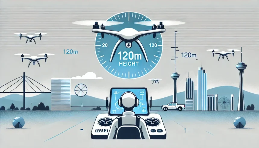
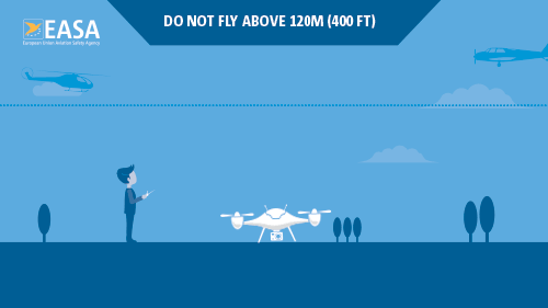
One requirement of the Open category is that you only fly 120 metres above ground level (AGL). However, some flights require a flight altitude of more than 120 metres for various reasons, e.g. for a better recording angle, a higher area performance per flight, an optimum flight altitude for sensors or simply at the request of the client.
In this blog post, we explain which flights above 120 metres are still possible in the Open category and what alternatives there are.
“Height above ground”
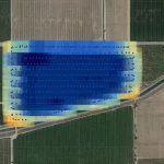
In flat terrain, the 120 metre rule is easy to implement and unambiguous: you read the displayed value of the drone’s current altitude on the remote control or via telemetry and keep it below 120 metres above ground.
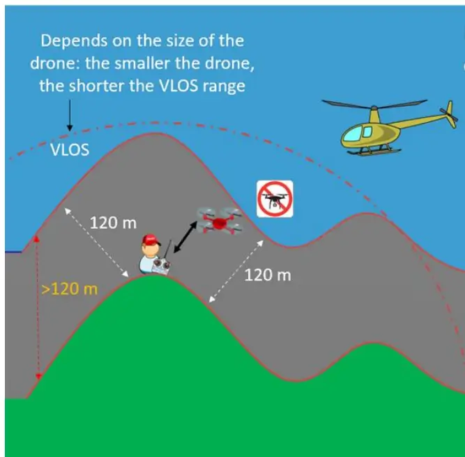
As the graphic shows, everything is clear in the lowlands. But what happens when the height of the terrain flown over – i.e. the height above ground – changes? Does the terrain rise or fall? What is the maximum permitted flight altitude of the drone in this hilly or even mountainous terrain? Where is the reference point – do I have to fly 120 metres perpendicular or above my starting point?
What is the maximum permitted altitude of a drone in mountainous terrain?
Article 4 (1)(e) Regulation (EU) 2019/947 – ‘Open’ category of UAS operations reads as follows (freely translated from English):
“During flight, the unmanned aircraft shall remain within 120 metres of the closest point to the surface of the earth, unless it flies over an obstacle, as specified in Part A of the Annex”
“To the nearest point on the surface of the earth” means that the altitude above ground level in mountainous or hilly terrain is not measured perpendicular to the ground, but the shortest distance of the drone to a point on the surface of the earth. This point can be on steep rock faces, slopes or mountain pastures – but is not displayed in any form on the remote control or telemetry, which makes it more difficult to maintain. Nevertheless, the flight altitude above ground level can be much higher than 120 metres if the shortest distance to the mountain is less than 120 metres.
Is flying over tall buildings permitted?
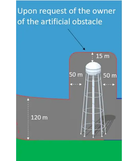
There is a further exception for flying over high-altitude infrastructure (over 105 metres):
“(3) When flying an unmanned aircraft within a horizontal distance of 50 metres of an artificial obstacle higher than 105 metres, the maximum height of UAS operations may be increased by up to 15 metres above the height of the obstacle at the request of the entity responsible for the obstacle.”
(EASA, Annex to Regulation (EU) 2019/947 Part A – UAS.OPEN.010 General provisions, p.261)
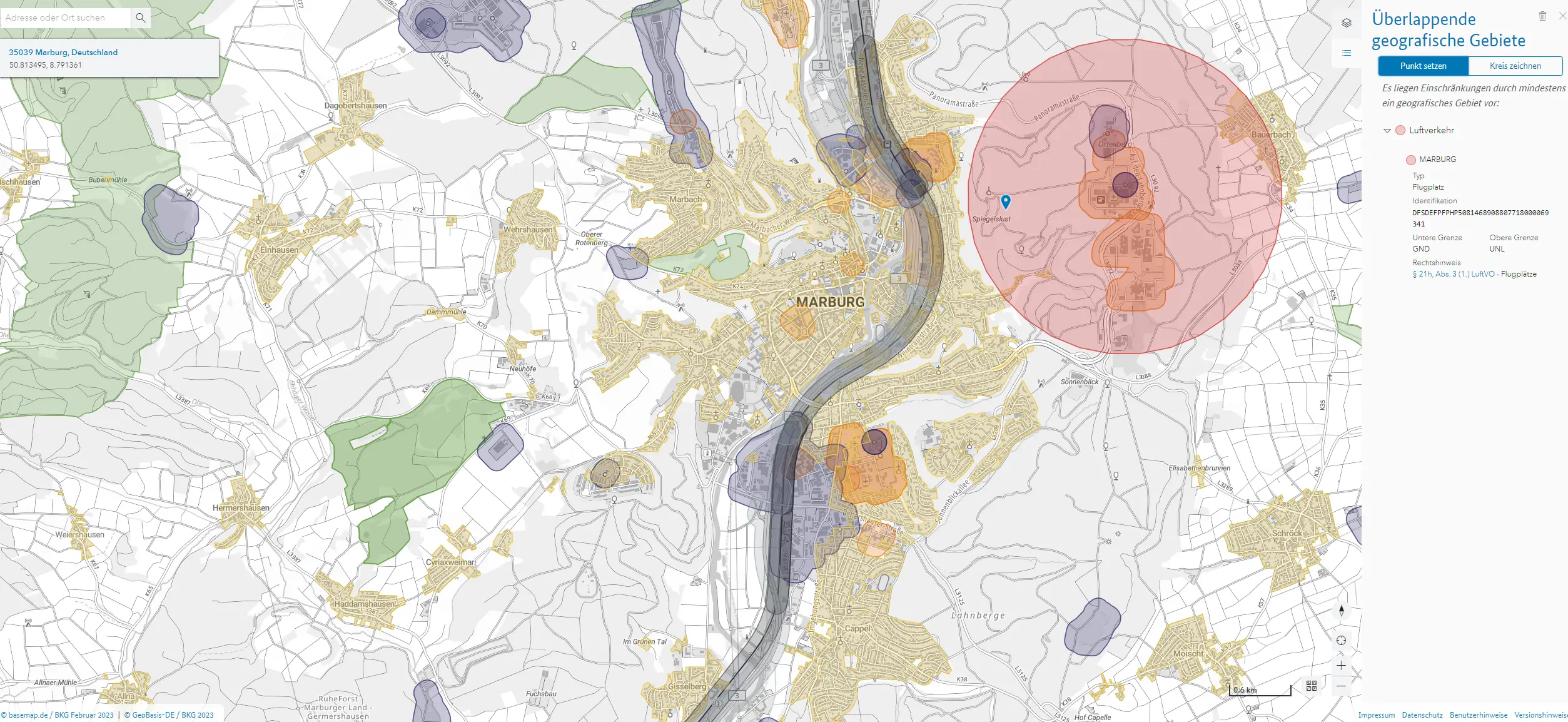
This exemption is particularly suitable for inspection flights of all kinds. However, in the presence of uninvolved persons, the requirements applicable to the respective subcategories, such as minimum distances or the 1:1 rule applicable in A2, must be observed. In addition, there may be national regulations, such as geo-zones, which specify other minimum or maximum flight altitudes.
Alternative: Fly above 120 metres
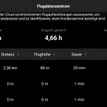
If these exceptions are not sufficient for your flights, you should obtain an operating permit for the specific category for flights above 120 metres with the help of the SORA(What is SORA?). This comprehensive risk analysis assesses the risk of a mid-air collision with manned air traffic associated with flight altitudes above 120 metres.
This requires information on the airspace structure, expected air traffic density and special activities in the airspace. Our wingman tool provides you with all the information you need after specifying the flight route, automatically calculates the air risk class, identifies the authorities to be notified and thus helps you to reduce the risk, save time and prepare the documents for the operating licence.
If you still need personal assistance, our SORA counselling service is of course available to you. If you are seriously considering flights in the Specific category, you can arrange a free initial consultation with us at any time by clicking on the link. We will be happy to support you in the realisation of your drone projects.